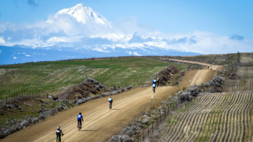
Search for a place to ride your bike in Oregon

Search by

Enter a Location

Examples: Portland or 555 State St. Salem 55025

or

The 7 regions of Oregon

Ride Options

Select a Ride Type

Off-road, often dirt

Paved roads or paths

Select a Length Range (in miles)

High Prairie Loop

  • Length:
    13.2 miles
  • Difficulty:
    Challenging
  • Attributes:
    Moderately Technical, Single-Track
  • Region:
    Mt. Hood / The Gorge
  • Nearby Cities:
    Odell, Hood River, Government Camp, Parkdale

Trailhead: From Hood River, head 31 miles south on Hwy. 35 to Forest Road 44 on the left. Drive up Road 44 for 5.4 miles to the Bottle Prairie trailhead on the left.

Highlights: Long climbs, great views, incredible single-track descent.

Note: You can easily combine this loop with the 8 Mile Creek or Knebal Springs Loops.  The hike up to Lookout Mountain from High Prairie at the halfway point of the ride is well worth the extra effort for the 360° view.

Seasons: Summer through fall

A detailed map of this trail and others nearby is available through Adventure Maps, an Oregon company, at local bike shops and outdoor retailers, as well as online at www.adventuremaps.net.

Comments

No one has posted a comment yet.

We’ve done this

We want to do this